Showing posts with label road conditions. Show all posts

Sunday, January 11, 2015

Road Trip NOIDA to Bilaspur in Chattisgarh


In Jun 2014 we took a road trip from NOIDA to Bilaspur in Chhattisgarh via Allahabad, Bandhavgarh, Amarkantak and then finally to Bilaspur.

NOIDA to Allahabad.

From Noida to Greater Noida it was the expressway till we reached the turning point for Yamuna expressway. This is a six lane expressway till short of Pari Chowk in Greater Noida. The speed limit is 90 km per hour but watch out for the dumpers, trucks and cars exceeding the speed limit and cutting suddenly in your lane and also for the traffic coming from service lane. Avoid office going and coming back time as it crowded and movement slow. Also keep a sharp look out for the dumpers and vehicles which have stalled in your or other lane with no indication or lights. A number of accidents have taken place due to these stalled vehicles. The traffic police are now installing intelligent traffic management system it is expected that traffic management may improve. Fill up fuel before you leave as it has no fuel pumps for 30 Km till Yamuna expressway and then 168 Km to Agra. Yamuna expressway has very good concrete surface and the speed limit is 100 Km/hr but watch out for the stalled vehicles and vehicles over speeding and overtaking from left and right both sides. It has three toll booths and a rather high price tag of Rs.320/= till Agra which you can buy in one go also. Bath rooms and restaurants are only after each toll booths. Bath rooms are good but the restaurants a little bit expensive. The whole expressway has no fuel pump except one which is 2 Km off the expressway somewhere in the middle. Do not stop in between toll booth as there have been quite a few armed robberies. There are no trees or shades on the central divider so you get glare in the night. Avoid night driving if possible. You come out on NH 2 about 11 Km after Agra. Turn left on the NH2 to proceed to Kanpur. For Agra you will have to take a U turn at about 1 Km after entering the NH2. You take this road till Firozabad where you will have to slow down as the highway passes through city with rumble strips at each crossing and an over bridge. But the problem starts as soon you come out of over bridge and come across the crossing at which the trucks take a right turn to avoid going into the city. This is a bottle neck area. After this you will be passing through Shikohabad and then bypass Etawah. At present the highway from Etawah to Kanpur is being made six lanes with a number of over bridges under construction. Hence you take the side road which has speed breakers and it brings your speed down.  Therefore this 170 Km stretch from Etawah to Kanpur will take approximately double time as compared to what it used to take earlier. After the Kanpur –Jhansi highway joins the NH2 then keep a good watch oh traffic especially, tempos, taxis and maxis till you reach the over bridge. The only good eating place on this stretch is at Skindara, approximately 70 km before Kanpur, where there is BP petrol pump and a dhaba next to it with a good parking behind the dhaba and reasonably good bathrooms and a place for family to sit and eat. The food is reasonable priced and is worth a break. By this time you will have covered approximately 380 Km from NOIDA, slightly more than half way through. At Kanpur you take the over bridge for another 25 Km of elevated road which effectively bypasses the whole Kanpur and come out to surface level after Chakeri near the Industrial area. The road from here is four lane with good surface but watch out for traffic coming from opposite direction of cars, trucks, tractors and motorcycles .The tractors and motorcycles keep popping up from various cut which locals have created.. This will continue till you reach Allahabad. At over bridges you will find buses, taxies, tempos parked on it thus reducing the width to effectively one lane. After Fathehpur you will find the road narrowing and suddenly your way blocked by a Mazar. The road takes a sharp right and back again to avoid it. Please keep your speed under control here.  $0 km short of Allahabad you come across an over bridge where the straight road will take you to the bridge on Ganga and then to Varanasi and a right turn after reaching the top will take you to the approach road to Allahabad. This 40 km road is two lanes with traffic of cycles, motorcycles, tempos and buses. Passing though habitation will bring the speed to almost crawling and the road is not very good either with speed breakers and potholes, some big enough to swallow your car. It is 40 Km till High Court and then this road, known as Kanpur Road, will also take you out of Allahabad to another bridge on Ganga at Daragaj and then to Varanasi after meeting the NH 2 about 35 Km from Allahabad. You can also take the road straight rather than turning right at 40 Km marking and go straight, cross Ganga and then take a loop to join the Lucknow- Allahabad road and come back to Allahabad after crossing Ganga again at Phaphamau. It is approximately a 680 Km trip from Noida to Allahabad which can be done in about 10 hours but with highway widening it now takes about 12 hours to reach Allahabad. So start early to avoid traffic near Allahabad and in the city. There are no public conveniences after you leave Yamuna expressway. The only reasonably good bathrooms are in the dhaba at Sikandara after Etawah and about 70 km short of Kanpur. There may some bathroom facilities in some big petrol pumps but that you will have to ask and check.

Allahabad to Bandhavgarh

Allahabad to Bandhavgarh is about 280 km via partly NH 7 and state roads. You can take NH 7 till Rewa and then turn left to take the road to Govindgarh and then the state highway to Shahdol. About 60 Km from Rewa you take a right turn and this road will take you to Bandhavgarh. The other road is to take NH 7 up to Amarpatan and then turn left to take the road to Badhavgarh. The third route is via Katni and is longer. We took the road via Govindgarh.  You come out of Allahabad towards the newly constructed Yamuna Bridge and take the straight road on the crossing after the bridge to go to Rewa. The road till the border of UP and MP, that is Chak Ghat, was a typical UP road passable but with potholes and in between good road. Avoid this stretch in the late evening and night as it is a nightmare to do this in the late evening and early night. The road from Chak Ghat to Rewa is being made six lanes and hence was reasonable only in parts with a lot of diversions and with little indication as to which direction for you to follow. So please use the vehicle ahead as a guide whether to divert left or right. At places the road was good. Hopefully in another year the road will be ready. Before entering Rewa leave the HN7 and turn left to go to the city and this road will take you as a bypass for the city to meet the road going to Govindgarh.  At Govindgarh turn right to take the state highway towards Shahdol.  About 60 Km and crossing the ghat section you approach a dam on river Son, you can take a slight diversion to go to the reservoir and enjoy the beauty. A few kilometers ahead, right next to the dam on the right hand side, there is a restaurant where you can get snacks (Poha, Dosa, Idli, stuffed paronthas, etc.), lunch and enjoys the beauty of dam and the river. The restaurant has its own garden for vegetables and fruits and the location is good with clean bathrooms and if you wish to stay then they have a few rooms also. Take a break and some rest here and enjoy the garden and the gardener gives lot of free advices on how to maintain your vegetable and fruit garden. Bandhavgarh is a small but good national forest where the chances of spotting a tiger are good. The reservation to safari is right next to the forest rest house.

Bandhavgarh to Amarkantak.

From Bandhavgarh there is a short route via Umaria to Shahdol but the road is not good till Umaria so we decided to come back the 40 Km to the state highway and turned right for Shahdol. The road a state highway was two lanes but with good surface and with little traffic it was a pleasure to drive through the forest. Before entering Shahdol take the bypass to go to NH 78 towards Budhar. After Shahdol, please be extra careful as the road passes through deep pits of open coal mines. Not only the road is bad for about 3 Km but at places it disappears in black soot completely. At Budhar you leave the highway and turn right to go to Amarkantak . It is a 76 km drive to Amarkantak with ghat section and beautiful forest and scenery. It is two lane road but good surface and little traffic hence you can enjoy the scenery. Amarkantak is famous and a religious place as it is the origin of two rivers, where Son River flows eastward and the other Narmada flows westward. It is place full of temples with beautiful scenery.

Amarkantak to Bilaspur

From Amarkantak there are two routes for Bilaspur. The state highway via Pendra, Kathgora and the other one the shorter one is via Achanakmar Wildlife Sanctuary. The road from Amarkantak via Achanakmar is two lanes but less in width and is a jungle road but reasonably good. At places some plaster has come out but motorable. It passes through the wildlife sanctuary hence you have to enter the details while entering and also on leaving. Most of this road is either ghat section or forest road and hence the forest and scenery is worth enjoying. Near the exit gate they have a booking center where you can take a guide from forest department and visit the scanctuary in your own car or take a gypsy on hire. It is called Achanakmar because earlier it was a dense forest and was full of leopards and they used to jump from trees to catch their prey. The drive through the forest is enjoyable and you might see bison, deers and maybe a Cheetah. This road will join the state highway coming from Mungeli a few kilometers before Bilaspur. This road will take you to Bilaspur city. In case you wish to go Raipur or by pass the city then before entering the city take a right turn on the bypass to go to Raipur.

Bilaspur to Allahabad

On the return trip we took a different route from Bilaspur to Amarkantak via Pendra. The road was good except the last 40 Km where the road was bad and we took hour and half more time than the route through Achanakmar. It is advisable to take to road through the Achanakmar wildlife sanctuary. This road comes out slightly ahead of Amarkantak and bypasses it. The route till Rewa was the same as we had taken earlier. At Rewa we decided to take the old road to Allahabad via sirmaur. T had less traffic even though it was two lanes but with good surface. If you take this road then make it a point to ask for directions to go to Chak ghat. The most surprising point was that the road took us to Chachai falls and we had to cross the river barely 100 meters from the 200 meter fall. It had rained so the river was full and it took quite an effort and skill to negotiate the 20 meters of the river. It was only after crossing the river that we realized how close to the falls we were. The fall is beautiful with a small hotel on the hill from where you can enjoy the falls and river. This stop revived my old memories of 1963 when we had visited Chachai and Kyoti falls as a kid. The road was almost a single lane but with good surface and we came out near Chak Ghat to take a left turn on NH 7 for Allahabad.

Allahabad to NOIDA

You take the Kanpur Road or the GT road to come out of Allahabad. But it is better to take Kanpur Road as it is less crowded and the GT road passes through the city with high density of traffic. The road will take you past Sulem Sarai, Bamrauli air force station and the Manauri air force station and finally will meet the NH 2 after traveling a distance of 40 km after Allahabad. Then the road is the same as was described earlier.

Wednesday, December 24, 2014

Road travel in Madhya Pradesh


                              Road Conditions in Madhya Pradesh

Route.

We had planned to take a road trip in our car, a Renault Duster, from NOIDA (UP) to over a number of places in Madhya Pradesh in our 18 days trip from 21 Nov 2014 to 8 Dec 2014. We covered almost the entire MP starting from NOIDA, Sagar, Vidisha, Sanchi, Bhopal, Indore, Omkareshwar, Mandu, Maheshwar, Tawa reservoir, Panchmarhi, Narsinghpur, Pench National Park, Kanha National Park, Jabalpur, Katni and back to NOIDA via Sagar. It was a 3500 km long trip.

Noida to sagar.
 From NOIDA to Sagar it was a distance of about 655 Km. The road from Noida to greater Noida was via expressway and in the morning mostly devoid of traffic except for a few trucks. The road is good but watch out for trucks changing lanes and taxis from the service road which appear unannounced. After Greater Noida to Agra it was via Yamuna expressway a six lane express highway with a toll tag of Rs.320/=, which does not justify the facilities provided, except for clean bathrooms after every toll barrier and there are three of them. The negative point was no tree or shades in the central divider thus in the night the headlights blind you, so avoid doing this stretch in night. Keep on the center lane but keep a watch from vehicles overtaking you from both sides. No fuel pumps so fill up before you enter the expressway. There is one about halfway but you have to leave the highway and go about 2 km to the Petrol Pump and come back again. The biggest bottle neck is Agra which you have to cross and with very few signboards to guide you in the city. Try crossing it early morning or be prepared for hour and a half to cross Agra except on Sunday and holidays when the traffic is less. Avoid Gwalior road sign near Taj Mahal as it will lead you to a road with poles in between with just enough for a small car. Agra to Gwalior is on NH 3 and it is a four lane highway with reasonably good road but at places surface is not smooth and watch out for local traffic. You almost have to crawl due to over bridge construction in Dholpur, as well as the stretch near Chambal river where you have to take the old bridge with bad road for about 5 Km.  Ten kilometers short of Gwalior is the diversion to bypass Gwalior and it is best to take it as it takes you through some institutional area and completely bypasses Gwalior. Avoid going through or taking the NH 3 to town unless you have to. Road from Gwalior to Jhansi was the worst stretch with road going through Dabra and Datia  and you have to keep switching from left to right to left again throughout the stretch. This stretch will take the maximum time. Drive slowly and watch out for speed breakers near unfinished over bridges, near town and villages. You bypass Jhansi by turning right before you reach town towards Guna and go about 5 Km and then left to take the newly made N-S corridor. It was a delight to drive from Jhansi to Sagar on this beautiful 205 Km stretch, excellent surface and beautiful surrounding with field and jungle. You leave the highway near Sagar to do a 5 km bad stretch of road and then drive into town. It took 10 hrs to do the entire stretch from Noida to Sagar at a moderate speed of 90 Km/hr and with breaks for toilet and refueling. The Duster behaved exceedingly well with an average of around 22 Km to a liter. We reached without feeling tired due to excellent suspension and very little roll or pitching. Avoid taking the NH- 3 from Gwalior to Bhopal as the road between Shivpuri to Bhopal is presently not in a good condition and we were told to avoid it and was the reason for us to go to Sagar first. Via Sagar is about 100 km long but then you do have to come back to Vidisha and the road is very good.

Sagar to Bhopal.
The Road from Sagar to Bhopal, 220 Km stretch, was via Gyraspur , Vidisha, Sanchi and Bhopal,  a state highway, rather taking the taking the direct route which has toll, from Sagar to Bhopal via Raisen. It was a two lane highway but very good surface and little traffic. We diverted 10 Km to go and see the Rahatgarh Falls.  A beautiful place in the hills and jungle, which brought back old memories. Another stop at Gyraspur to see the remains of ancient temples called Athakhambe and Chaukhambe and then to Vidisha to see the Heliodorus pillar and finally to drive 10 km to see Udaygiri caves. This 10 km is partly village and partly jungle road. Take the bypass road in Vidisha rather than going through the city and avoid its traffic and a busy railway crossing. The caves required a lot of walking but worth seeing. From there it was to Sanchi via Vidisha again, as the direct road from the caves to Sanchi was not in a good condition.  Sanchi has the famous Stupas and an important place of Buddhism. From Sanchi it was a straight run to Bhopal. The road was good except for a few patches but a lot of traffic. We reached Bhopal at about 1500 hrs.

Bhopal to Bhimketa and Bhojpur
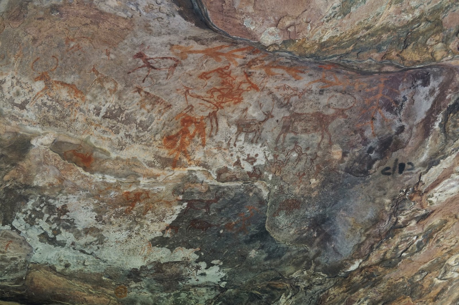
New Bhopal is a lovely city with good roads, Lakes, parks and a lot of trees. The Road from Bhopal to Bhimketa caves, about 40 Km away, which is inside Rattapani national park is good except for the last 10 Km which is a forest road and you had to pay Rs.100/= to enter the forest. Caves with their ancient paintings and the forest with monkeys, langoors and the birds made it delightful. The newly opened Van Vihar national park in the city with a jungle safari was an excellent example of what can be done within the city limits by dedicated forest officials in MP. The road to Bhimketa was a two lane but with lot of traffic and overtaking trucks was a challenge due to oncoming traffic. Watch out for the sigh to turn right as it is just on the turning and you miss it if you are not careful. Cross the main railway line and you are in the forest and a 10 km drive on forest road takes you to the caves. From Bhimketa  to Bhojpur the scenery was beautiful and the massive shivling at Bhojpur made you feel small. The temple half- finished and its plan etched on the stones nearby and the garden with the river nearby was really worth visiting. Part of this road was under repair but manageable.

Bhopal to Omkareshwar
The road from Bhopal to Indore, 190 Km four lane state highway, was again very good with excellent surface and then at Dewas it meets the NH 3 to Mumbai. Dewas is by passed if one wishes to and a slight diversion can take you to the Ujjain, the Shipra river and the Mahakal  temple, one of the twelve jyotirlings in India. We were going to see another on the island of Omkarehwar formed at the meeting point of Kaveri and Narmada river. It is an island shaped like OM in which the shivling is situated. We had seen Ujjain and hence we pressed on to Indore. The City is bypassed by the NH-3 and we took a slight diversion after half way through the bypass to the town to meet  our daughter’s in laws based there and have lunch with them. Do not miss the Gulab Jamuns ( Mawa Bati)  enroute at Sonkatch. The Dhaba is right on the highway out of the Town. After Indore you turn left towards Khadwa for Omkareshwar, a distance of 90 Km. The road again was a two lane state highway but very well maintained and good surface. It has hill section with excellent forest, scenery and some very good picnic spots. After crossing Narmada you turn left and go about 13 Km to reach Omkreshwar. The road was a two lane road but reasonably good.

Omkareshwar to Mandu and Maheshwar.
From Omkareshwar to Mandu it was a run of about 145 km. From Omkareshwar we again came back to Barwah on the Khadwa Indore road and then turned left to take the road to Maheshwar and to Mandu. The road to Maheshwar was a state highway, two lanes but with very good surface and low traffic density. You go upto Dhamnod after Maheshwar to meet the NH-3 again. Take the under pass at NH-3 to proceed straight rather than going on NH- 3 and then turning left at Milan Dhaba about 11 Km away from Dhamnod for Mandu. This narrow road after turning left at Milan Dhaba was good but too many villages and too many speed breakers was a nightmare to drive. If you go straight by underpass and travel another 15 Km on the road and then at the village turn right to go to Mandu then the road is slightly wide with hardly any villages and speed breakers. Near Mandu the road is not good. We took the village road to come back to Maheshwar . Mandu to Maheshwar was about 57 Km.

Maheshwar to Tawa Reservoir.
The distance from Maheshwar to Tawa reservoir was about 347 km. We again came back to Barwah from Maheshwar to take the state highway from Indore to Khandwa. It was the same two lane state highway but good surface but the only negative point was the drive through Khadwa after turning left from the state highway. The road was under repair in the city with high traffic density and no signboards showing Harda or Hoshangabad. The GPS was taking us through very congested inner roads but a local person guided us to an over bridge and then through reasonable open roads to out of Khandwa. The road from Khandwa to Harda again was a state highway but very good surface but with lot of road blocks and police checking due to local elections. Crossing Harda was tough with narrow roads and no signboards till you are almost out of town, exercise care and drive slowly and ask for directions. From Harda it was a straight run towards Hoshangabad on the state highway, again a two lane good state highway. About 25 km short of Hoshangabad take the right turn for Itarasi and there is a signboard showing it. You do not have to go to Hosangabad to come back to Itarasi. The road is a single lane narrow road but with reasonably good surface for 30 Km to reach Itarsi. You come out and join the state highway from Hoshangabad to Betul after most of the town and very near Cantonment area. Turn right at Itarasi on the Itarasi-  Betul road (NH69) towards Betul. The road is bad for about 7 Km with lot of potholes and heavy city traffic. I was told that the stretch from Hosangabad to after Itarasi was bad and is under repair. This was the first stretch in MP which we found bad and reminded me of the state of roads in MP about 8 years back. After about 7 km you are on ghat section with thick forest and you suddenly come across a road going left with a signboard for Tawa town and reservoir. Take this forest road to about 22 Km of thick forest to the banks of Tawa reservoir and a further 1 km takes you to Tawa resorts. The road is narrow but smooth and with very good jungle view.

Tawa to Pancmarhi.
Permission was taken from the Tawa Dam authorities to cross over the dam and enter the Satpura National Forest. The distance from Tawa to Panchmarhi is about 150 Km.We were advised to drive slowly over the dam as it was under repair and also slowly in the national forest stretch. The road was single lane forest road but with good surface. The view was enchanting and we turned a corner and suddenly found a Sambhar barring our way and questioning as to what we were doing in his territory. The river and the forest view was simply superb and we drove slowly just to enjoy the view and the wild animals. After about 15 Km we turned left and towards the Hosangabad- Pipariya highway and meet it near Babai. A drive of 20 Km but the road was not good with potholes, bad patches and passed through villages, so drive slowly and carefully. This was the first village road which was not good. At Babai we turned right to go towards Pipariya and then to Pancmarhi. On the way just two Km before Sohagpur there is a turning to the right to go to Madai, an official entry point and start of jungle safari to Satpura National Forest. From Pipariya to Panchmarhi the state highway was two lanes and with good surface till we turned right and left it for Panchmarhi. The road now was typical hill road, good surface and some excellent view of the river. Pachmarhi is inside the buffer zone of national forest; hence the old colonial buildings are still there and the AEC center. A small quite hill station with notorious monkeys who will go inside the car and take away anything that is inside. So keep your vehicle always locked up with windows rolled up at all times while in Pancmarhi. We had a strange encountered when a monkey almost got through the legs of my wife to reach inside the car and was trying to take a bag of oranges before we managed to shoo him away but he just kept sitting and staring at us from a distance of 5 feet..

Panchmarhi to Narsinghpur.
The distance from Panchmarhi to Narsinghpur is about 176 Km. The road was the same till Pipariya as it is one of the entry points for Panchmarhi from north. After Pipariya we turned right towards Narsinghpur. The road again was two lane, which by now we realized was the standard state highway in MP, but with good surface. However on this route there were places where the road has small potholes and surface had come out but still it was reasonably good. At Kareli we again turned right on the N-S corridor to cover the rest 30 Km on it. Near Narsighpur we turned right to the city to reach my wife’s ancestral place. 

Narsingpur to Pench.
Narsinghpur to Pench National Park (Karamajhiri) is about 170 Km via Seoni and then to Karmajhiri forest rest house. The road was the same N-S corridor which takes one to Nagpur and further. We took this road to about 15 Km after Seoni and then turned right to take the village road to the 30 Km drive on village road and forest road to Karmajhiri forest rest house. The forest rest house in located just on the entry point with very good scenery and jungle view and reasonable rates. At night you may even hear tiger calls. It only has two to three safari jeeps so book early or you can get one from Tourani gate by paying extra. It is one of the entry points to Pench National forest the other being 30 km down the N-S corridor and then turn right at Khawasa to travel 13 Km on forest road to reach the Tourani gate. Last 10 Km of the Karmajhiri road was the forest road but was being done up. In MP you only pay the park fee on line and the safari and guide charges are extra and paid at the gate.

Pench to Kanha.
 From Karamjhiri to Kanha-  Kisli forest rest house was a 177 Km run. We took a slightly different road as advised by locals and then the same village road for the rest of the trip to reach the N-S corridor. This route had only 5 Km of forest road and was in a better condition. The road up to Seoni was the same and at Seoni we took the bypass to avoid Seoni city. The road was not so good but not bad either but was a let down as compared to other state roads. If we had taken the regular route through the city and then turned right then the road was said to be good but with city traffic more time was needed. After 10 km we met the regular road coming from the city. The road was the same two lane state highway and we made good time till we reached Chiraidongi after driving 140 Km and left the state highway and turned right to take the village and forest  road for another 37 Km to the Kisli forest rest house. The road was good and we made good time to the Khatia Gate, the official entry point to the Kanha National forest. Our forest rest house was another 3 km inside the national park from the gate. We were advised to drive at 20 Km an hour only on this road and the view with Cheetals and Sambhar grazing by the side of the road was beautiful and worth the slow drive. 

Kanha to Jabalpur.
From Kisli forest rest house to Jabalpur was a 165 Km run. It was the same 37 Km of village road till Chiraidongi and then we turned right on the state highway to Mandla. A 30 Km drive with good road. At Mandla we met the NH-12A coming from Chattisgarh. The drive from Mandla to Jabalpur was through forest by the side of the Bargi reservoir and the road was good. At places the view was simply superb. There is a steamer service which one can take from Bargi to Madla and then go to Kanha. It was a 100 Km drive from Madla to Jabalpur and only on reaching Jabalpur we encountered traffic except for a village fair traffic after Mandla. 10 Km short of Jabalpur there is a left turning for 20 km of village road to drive to Bargi reservoir but we skipped it as it was getting late and we wanted to reach the destination before dark. We thought that we will do it tomorrow and take the 10 km drive from NH-7 after Bhedaghat but then the 10 Km route from NH-7 to Bargi was badly broken and we could not do Bargi Resorvoir. The road from Jabalpur to Bhedaghat was again very good as well as the portion of NH-7 which we encountered on our way back.

Jabalpur to katni.
The distance from Jabalpur to Katni was about 100 Km on NH-7. We took the Jabalpur by pass to avoid the city traffic. The road was good but avoid entry and exit from Jabalpur in the morning hours between 0800 to 1100 hrs and in the evening between 1700 hrs to 1900 hrs as the road from Jablapur towards Sihora for another 40 Km is choked with local traffic and driving in it was like driving in the city itself. After 40 Km it was smooth sailing till Katni and we reached there well in time.

Katni to Sagar.
 Katni to Sagar via Damoh is a straight run of 180 Km but we were advised not to take the direct road to Damoh as it was bad but to go back for another 40 Km towards Jabalpur road to Sihora and then turn right to take the village road for another 15 km and then meet the Jabalpur- Damoh state highway. It was the second state highway which we found not to be good and were told to avoid it. After Damoh we turned left to go to Sagar on the Katni-Sagar state highway. The road was state highway and good. Incidentally almost all the state highways in MP are two lanes with good surface but with toll. The toll is minimal and one does not mind paying it.

Sagar to NOIDA.
It was the last leg of our journey. We started early in the morning at 0600 hrs to reach NOIDA by 1630 hrs. Road condition has already been described in our journey from NOIDA to Sagar. The only bad points we faced was near  Jhansi- Gwalior stretch, near Dholpur and the Agra city traffic with hardly any signs guiding you to Yamuna Expressway. There are signs for Delhi but that will take you to NH-2 and to Delhi via Mathura, Palwal and Faridabad, a bad stretch to drive due to heavy traffic and slow progress at Mathura and Faridabad.


General Road Conditions MP
All the state highways in MP are two lane but with very good surface. They have toll on all these state highways but the toll is minimal and you get good driving comfort and also good mileage from your vehicle. The other state roads and not state highways or the roads which lead to villages are mostly with good surface but single lane and the road within the village is cemented. But be careful of speed breakers on these roads while entering or leaving the village and at some places there are more than two speed breakers. Some roads are under repair while it is only 5 % of the roads that are not good. Overall driving in MP is a pleasure and you enjoy the beautiful scenery and the forests. Eating places are confined mostly to the cities or near cities and wash room facilities are non- existent and confined to some of the petrol pumps. Carry lot of fruits and eatables till you can find a decent eating place. On the way you will be able to get lot of seasonal fruits being sold on the roads which are locally produced. Carry a repair kit and a battery operated compressor if you are using tubeless tyres. We carry as standard equipment a full tool kit, a battery operated, jack, wheel nut opener and compressor along with our faithful Swiss knife and a full medical box. Have a good GPS device with you but use it cautiously within the city as it will take you through congested shortest route rather than the long open roads. Do not hesitate to ask for directions within the city frequently.